
A VR Environment for Archaeological Analysis and Re-Presentation

Presented at the Archaeological Institute of America Annual Meeting, January 7 2023
Extending the 3D Model: Immersive Virtual Environments for the Reproducibility of Archaeological Results
Allison Smith (Indiana University) and Matthew Brennan (Indiana University)
Abstract:
3D digitization and virtual reality (VR) in archaeological fieldwork and study have been the focus of research since at least the 1990s, notably P. Reilly (CAA 90 [1991]:132-139). Indeed in recent years, 3D digital data collection has become a standard practice in nearly all archaeological excavations, generating a profusion of spatial data and visualizations. Despite the near-universal implementation of 3D digital technologies, the products of these efforts often remain trapped in proprietary software. They thus are relatively inaccessible to those without specific tools or skills. Such object-centric environments also necessarily abstract the data from the archaeological context and experience.
First, this paper examines the existing use of 3D digital models in archaeology to establish the current state of use. Then, using photogrammetric models produced during the course of excavations of a Roman bathhouse at Cosa (Ansedonia, Italy) between 2015 and 2022, the authors address successes and shortcomings in the collection, presentation, and applications of such material within the archaeological workflow. In particular, this paper questions the ease of use and accessibility of the results, which currently function as little more than visual complements to traditional archaeological documentation. Clearly, the extent to which these models can be used in research has not yet been realized. Thus, we present a framework for an immersive virtual reality environment that allows for the analysis, re-visitability, and reproducibility of the excavation process and conclusions. As archaeological methods have evolved, so too must the presentation of findings. Our framework shifts the mode of data presentation to an immersive and interactive 3D environment that complements and extends the narrative field reports. This approach weighs current technologies and practices, with a mind toward open-source, readily available, and transparent technologies that can be used in research and classroom applications.
Functionality
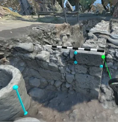
Screenshot showing 2-point distance and 4-point area measurements.
Toggling between temporal excavation layers.
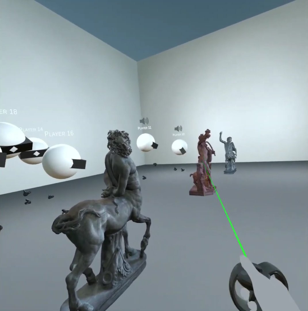
Multi-user collaboration with voice-over-IP and synchronous avatars/functionality.

Integrated field notes and drawings tied to each stratigraphic unit layer.
If you’d like access to the Unity project, or would like to use the framework on your own dig, please contact us!